OUR SOLUTIONS
Scalable, Rapid & Automated Monitoring for All Industries
- Automatic acquisition calculation, classifications & analysis
- Motion & infrastructure type detector
- Up to 350 meters range
- Quick & easy installation
Our solution simplifies 3D point cloud acquisition and processing, making it easy for anyone to set up and monitor infrastructure and industrial environments.
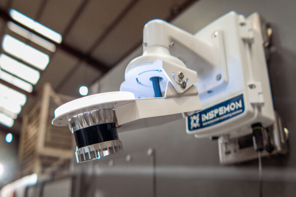
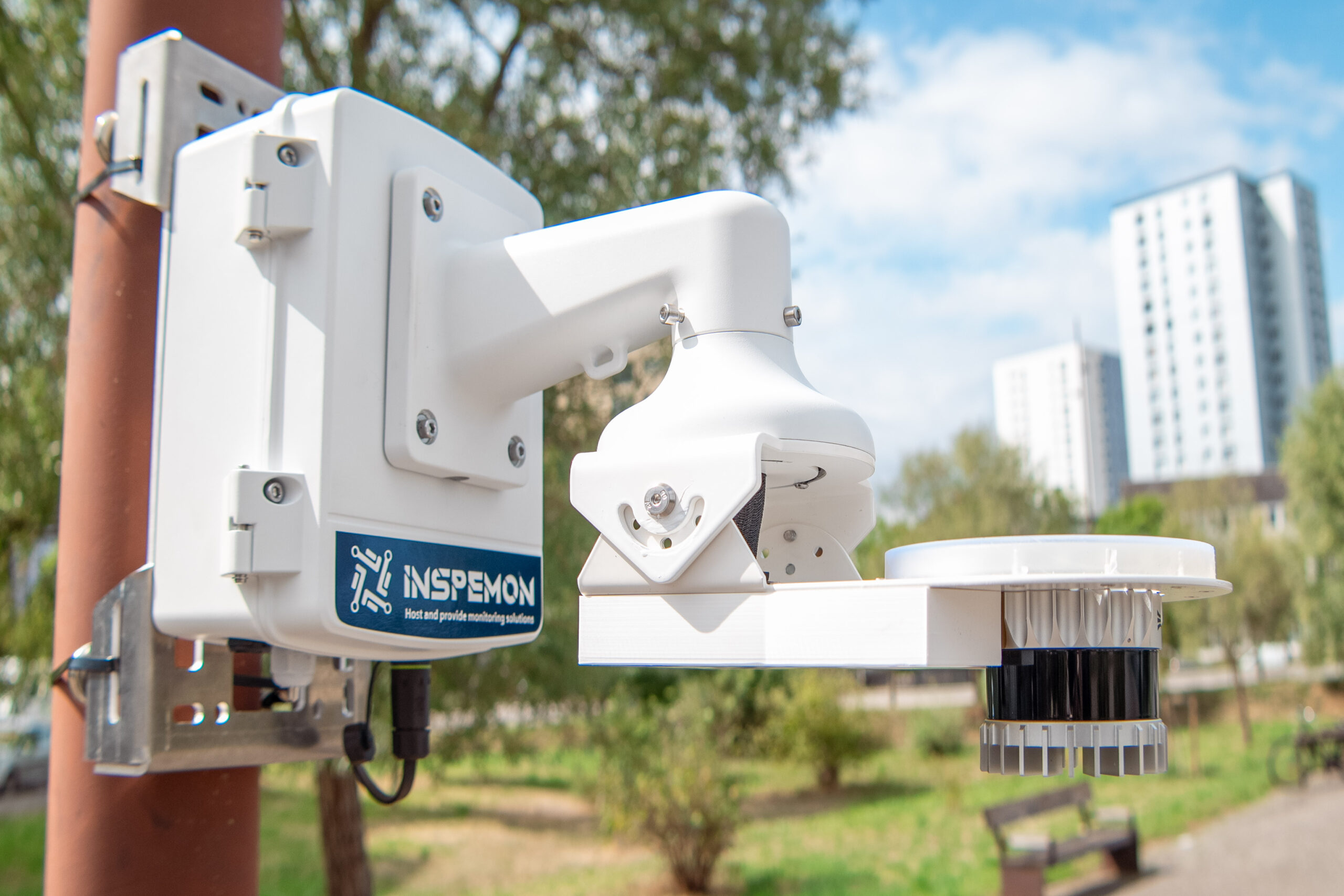
OUR DEVICES
LiDAR that adapt to every infrastructures & construction works
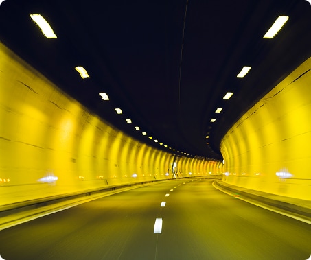
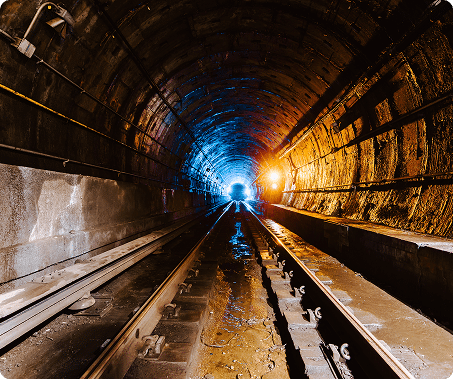
Railways, tunnels, bridges & industrial sites demand constant, precise supervision.
Inspemon delivers a streamlined, plug-and-play infrastructure monitoring solution for you to acquire automatic scatter plots.

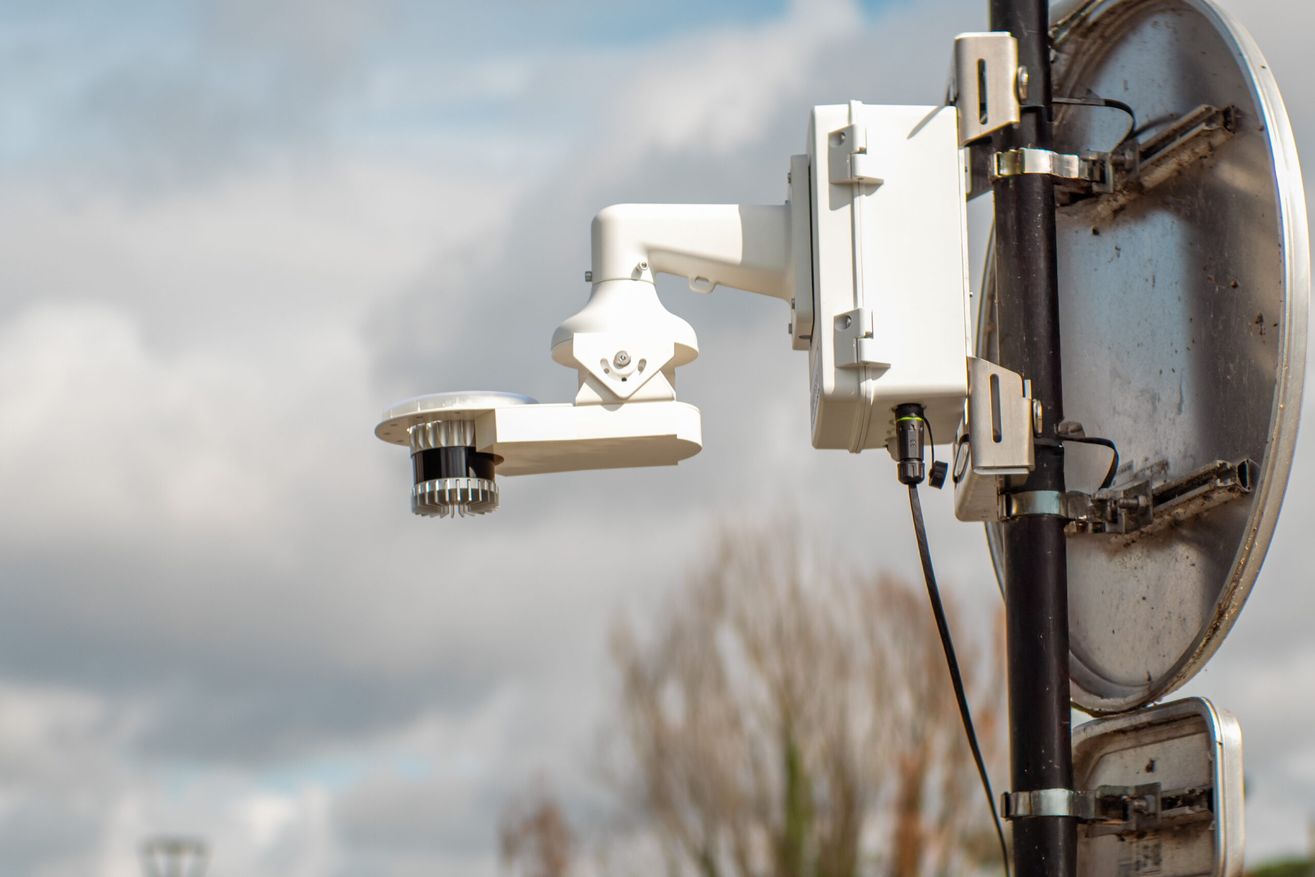
Robust devices
- Durable and Weather-Resistant
- Shock and Vibration Resistant
- Long-Lasting Reliability

Easy plug-and-play
- Explanation about installation
- POE (Power Over Ethernet) for Remote Operation
- Seamless Automated Processing and Segmentation

Automatization
- Automated Data Collection
- Scheduled and Remote Operation
- Automatic identification & classification of humans, vehicles & vegetation
- Generated reports & analysis
Which device best meets your needs ?
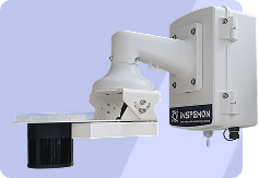
AML001SR
Short range
AML001LR
Long range
Equipement
Structure
Aluminium
Repeatability
< 1mm
< 5mm
Range
up to 45m
up to 400m
Adjustable head
3 axes ± 20°
Integrated thermistor
Yes
Alert bipper
Yes
Height
35 cm
Width
25 cm
Depth
56 cm
IP rating
IP68
Automatic cycles
Up to 1 minute
Alimentation
PoE++ (up to 150 meters RJ45 cable)
Sensors
View
Vertical: 180° Horizontal: 360°
Vertical: 22.5° ± 1.0° (+11.25° to -11.25°) Horizontal: 360°
Channels
128
Operating Temperature
-40℃ to 85℃
Points
1,728,000
A versatile solution : Choose your network architecture
Inspemon gives you full flexibility to build the monitoring network that fits your project.
Whether you need a single Lidar, multiple synchronized sensors, or a distributed monitoring system, our solution adapts to your needs.
PREVENT ANY DAMAGES
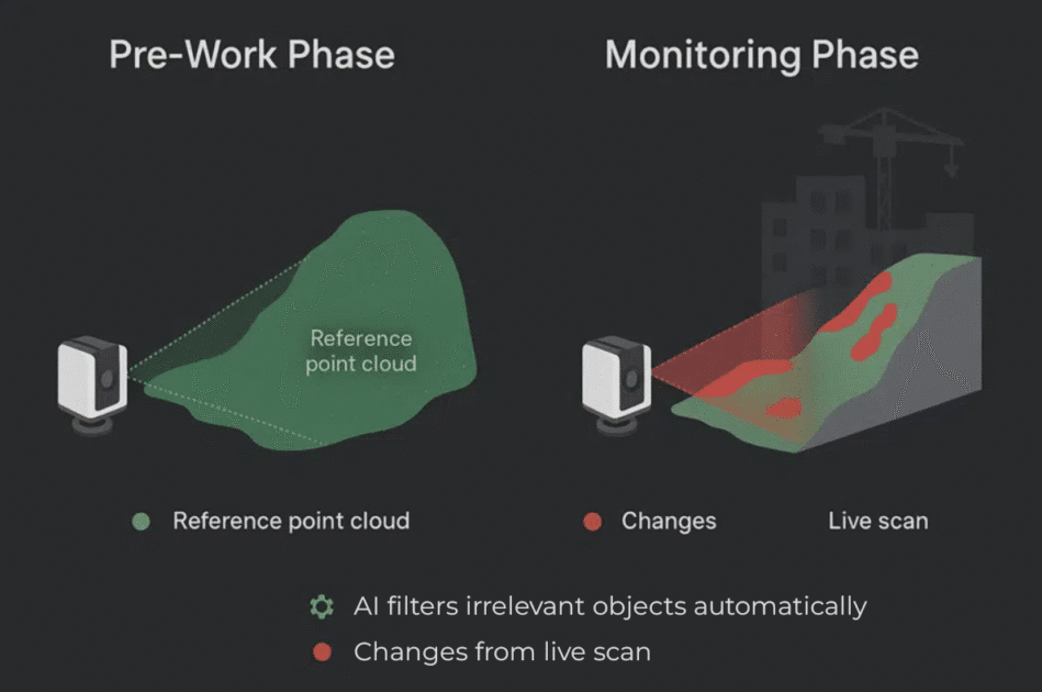
From Reference to
Real-Time Monitoring
Inspemon’s AML solution integrates seamlessly with geotechnical, geodetic, and environmental sensors to provide continuous monitoring of civil infrastructure.
From bridges to tunnels, our automated 3D point cloud data enables rapid detection of structural changes, ensuring better safety and operational efficiency throughout the lifecycle of assets.
Step 1
Pre-Work Phase : Build the Reference Model
Before construction begins, our Lidar system scans the entire environment multiple times. Our platform automatically averages these scans to create a clean, high-density reference point cloud, focused only on zones of interest (e.g. foundations, walls, terrain, etc.).
Step 2
Construction & Monitoring Phase : Detect Every Deviation
As work progresses, the Lidar(s) continue scanning. Each new scan is automatically compared to the original reference model to detect any deformation, displacement or anomaly in real time.
INSPEMON CLOUD PLATFORM
Smart Software &
Data Analysis
Inspemon’s software automates point cloud assembly and classification, filtering out irrelevant data for industrial and building applications.
With AI-powered analysis, it provides automatic part dimensions and scan comparisons, streamlining monitoring and decision-making for faster, more accurate results.

AI Automatic Detection
Automatic identification & classification of :
- humans
- vehicules
- vegetation
(and automatic suppression possible)

Generated Reports
Measures & analysis automatic export

Third party integration
Integration Assembly/AI
and Acquisition via a REST API

Cloud Platform
Inspemon’s cloud platform simplifies data storage, processing, and analysis, offering seamless access to point clouds and real-time insights from anywhere, anytime.

Real-time data access
Inspemon captures high-density 3D point clouds, providing accurate, detailed representations of environments for precise monitoring and analysis.
Benefits
How does Inspemon
revolutionize your workflow ?
Cost-effective &
high accessibility
Our devices takes 1.5 hours to set up (in comparison traditional solutions can take up to 13 hours to install)
Automatic & fast 3D modeling
Our solution integrates effortlessly with your existing infrastructure, eliminating the need for complex setups or on-premise software.
Continuous Support & Improvement
We provide ongoing support and regular updates, ensuring your system evolves alongside technological advancements and changing needs.
Evolutive solution
The device can be upgraded with new sensors to boost sensitivity and range as your needs grow.
Combination of both hardware & software
Chose our SaaS plaform as the quickest & most intuitive way to analyze your data.
Fast & adaptive data collection
Data can be collected every seconds.
We have one of the fastest system.
WE ADAPT
Applications Across
Industries
Discover how can you benefit from our solutions
- Construction
- Civil Infrastructure
- Transport
- Industry & Energy sites
Construction Sector
Remote control & programming
Continuous 3D scanning on site
Smart AI-based analysis engine
Fully automated 3D acquisition & processing
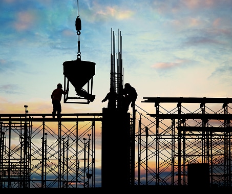
Inspemon delivers automated 3D monitoring systems for construction sites, enabling real-time modeling of evolving environments. Installed statically or on mobile rigs, our systems collect and process point cloud data autonomously.
Our intelligent engine automatically classifies objects, excludes outliers, compares real conditions to digital plans, and detects structural or geometric deviations—all directly accessible on our cloud platform.

Seamless hardware + SaaS
integration for live
analytics

3D automation for site
deformation, structural
checks, and progress tracking

High-speed 3D acquisition in under 15 seconds
AI-powered anomaly detection
and data classification
Your needs
Our input
Benefits
General Contractor
Monitor progress and geometry during construction
Continuous 3D scanning + AI analysis
- Early detection of deviations
- Better planning
Site Engineers
- Prevent and detect deformation
- Prevent and detect settlement
Real-time digital twin with smart alerts
Safer operations, reduced
rework
Quality & Safety
Maintain compliance & document conditions
Automated data acquisition & traceability
Reduced errors, fast audits
BIM/Survey Teams
Compare on-site state to BIM or CAD
Automatic model-to-point-cloud comparison
- No manual post-processing
- Increase the measurement frequency
Earthwork Stability Monitoring
autonomous 3D scanning
Continuous tracking of displacement
Smart AI-based engine
Fully automated collection
Inspemon equips civil construction sites with automated lidar stations to monitor earthwork stability in real time. Embankments, temporary works, and backfills are scanned continuously. Our AI engine segments ground from machinery or vegetation, filters outliers, and identifies any displacement or deformation automatically.
Data is processed in real time on our platform, ensuring reliable alerts for early intervention—without human error or delay.
Seamless integration with site workflows
3D automation enables precise deformation alerts
Volume change detection within seconds

Earthwork geometry tracked over time
Your needs
Our input
Benefits
Construction Managers
Ensure slope & foundation
stability
Continuous 3D earthwork monitoring
Early detection of displacement
Civil Engineers
Analyze volume changes & settlement
Real-time point cloud comparison
Better risk control, fewer manual survey
Safety Teams
Prevent landslides or unexpected collapses
AI filters moving machinery, classifies terrain
Real-time alerts, enhanced safety
Project Owners
Monitor compliance with engineering plans
CAD model matching & digital twin
Quality assurance and traceability
Bridge Vibration & Alignment Monitoring
Continuous vibration and geometry analysis
High-frequency 3D scans
Integration with vibration sensors
Fully remote data acquisition and processing
Inspemon deploys fixed lidar stations and integrates with vibration sensors to monitor bridge behavior under dynamic loads (trains, vehicles). Our AI engine isolates structural features in the point cloud, filters traffic or weather-induced outliers, and highlights any deviations or abnormal vibrations.
Combined vibration and 3D data are processed in real time to create digital twins and alert stakeholders of structural fatigue or misalignment.
AI-powered detection of abnormal oscillations
Long-term evolution tracking under operational load

Remote control and instant cloud visualization

Designed for transport safety and infrastructure resilience
Your needs
Our input
Benefits
Rail Authorities
Monitor bridge safety during train passage
Monitor bridge safety during train passage
Fast anomaly detection, minimal disruption
Transport Engineers
Measure long-term structural fatigue
CAD & real-world model comparison
Better lifecycle planning & upgrades
Maintenance Team
Schedule targeted inspections
Smart alerts, AI-classified data
Save time, reduce unnecessary checks
Public Agencies
Ensure safety compliance over time
Digital twin & historical data analysis
Compliance proof, informed decision-making
Air industry
Remotely programmable & controllable
Continuous scan
Smart analysis engine
3D automatization
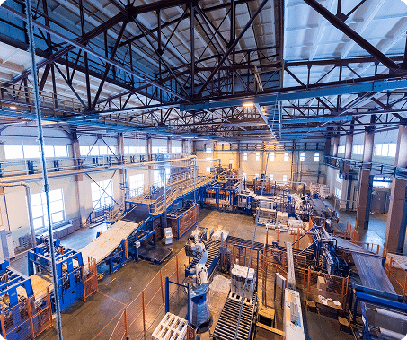
Inspemon designs and deploys fixed 3D scanning systems for industrial environments, capable of capturing the entire production space in seconds. All data is processed automatically through our platform, where our AI engine performs scene assembly, anomaly detection, and volume calculations.
By combining hardware with SaaS, we provide manufacturers with a turnkey solution for dimensional inspection, part verification, and logistics optimization.
3D automation for large part inspection
Seamless SaaS + hardware integration
Less than 15 seconds to capture a full scan
AI-powered point cloud classification & filtering
Your needs
Our input
Benefits
Equipment supplier
Dimensional compliance of complex parts
Automatic part inspection in 3D
Reduce scrap, increase first-pass yield
Industrial Logistics
- Flow optimization &
- Package verification
3D scan of load volumes
Fewer shipping errors, reduced waste
Maintenance & Services
Field inspection & digital twin creation
On-site 3D scanning & comparison to CAD
Targeted interventions, less downtime
Manufacturing Lines
Seamless quality control at scale
3D integration into FAL with alerts
Energy savings, higher productivity
add-ons
Complete your equipment
Add solar power, a modem for remote access, or pole mounts for easy field installation—adaptable to any site.
Communication modems
Ensure remote access and real-time data transfer with built-in 4G/5G or LoRa modems—no need for on-site retrieval.
Solar Stack Solutions
Power the device autonomously in remote areas like dams or off-grid sites—no external power needed.
Mounting & installation kits
Easily install the device on poles, walls, or custom structures with ready-to-use mounting kits—built for fast, secure setup anywhere.
Documents
Visit our resources and explore demo videos to find out more about how our solutions can be the right fit for your infrastructure monitoring needs.
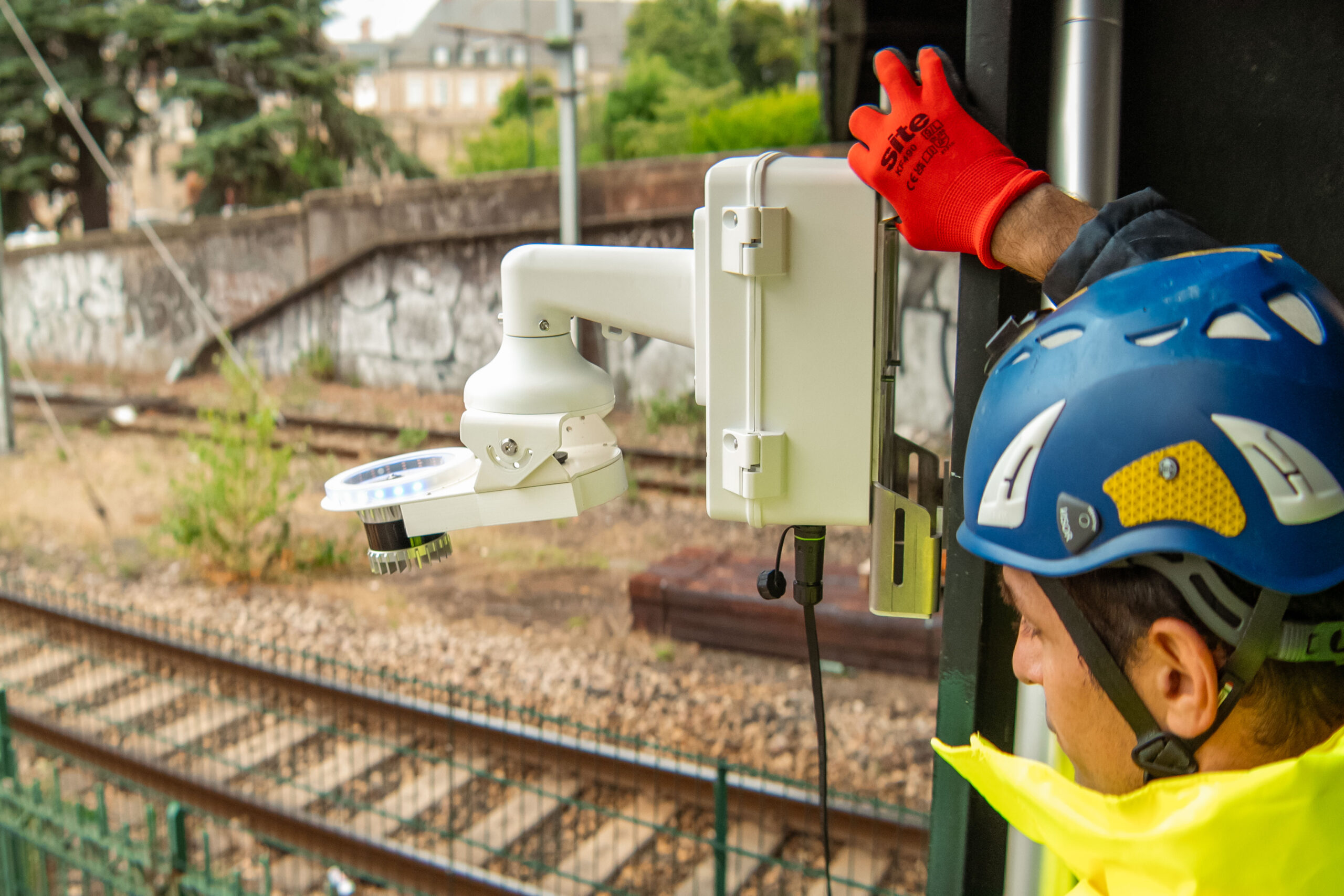
How to Install and Configure Your Inspemon LiDAR
Step-by-step instructions to set up your LiDAR device, connect via PoE, and ensure accurate calibration.
This guide covers hardware installation, network configuration, and initial data acquisition for seamless integration with the Inspemon Cloud platform.
Best Practices for Automated Monitoring with Inspemon Cloud
Learn how to create automated workflows for continuous data collection and analysis.
This guide explains how to add an AML (Automated Monitoring LiDAR), set alert thresholds, and leverage AI for predictive maintenance and real-time visualization.
