industries we serve
Civil Infrastructure
Monitoring
- Dam Structural Integrity
- Bridge Expansion Monitoring
- Riverbank Stability Surveillance
- Retaining Wall Monitoring
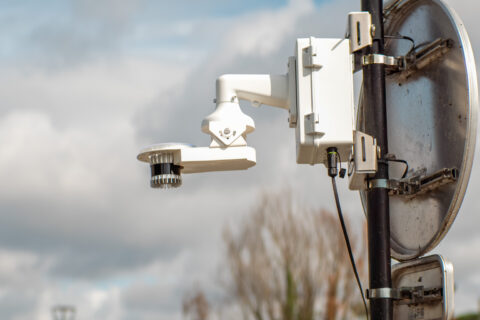
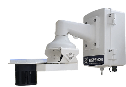
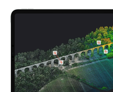
Inspemon provides continuous, automated monitoring of bridges, roads, and dams using high-density point cloud data. Our solution tracks structural movements, deformation, and environmental changes in real time. This ensures early detection of issues, improving safety, efficiency, and maintenance planning.
adaptation is key
Tailored for the longevity of infrastructure.
Inspemon’s AML solution integrates seamlessly with geotechnical, geodetic, and environmental sensors to provide continuous monitoring of civil infrastructure. From bridges to tunnels, our automated 3D point cloud data enables rapid detection of structural changes, ensuring better safety and operational efficiency throughout the lifecycle of assets.

Automated Deformation
- Adapts to infrastructure stages: construction, maintenance, and refurbishment.
- Delivers consistent 3D data over time for proactive management.se point clouds automatically, every few seconds.
- Supports long-term monitoring and compliance documentation.

Scalable Remote
- Quick installation with no need for manual surveying.
- Captures dense, high-frequency point clouds with minimal downtime.
- Deployable across multiple infrastructure projects simultaneously.

Sensor Integration
- Works with GNSS, inclinometers and environmental monitoring devices.
- Centralizes geotechnical, structural, and environmental data for better decision-making.
- Automates integration of multiple data sources for smarter monitoring.
civil infrastructure monitoring
Automated Insights for the Long-Term Stability of Critical Structures
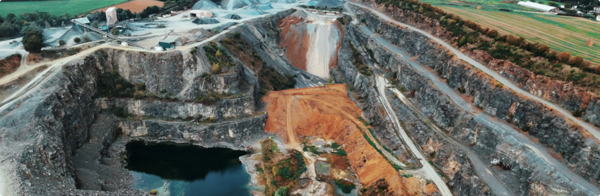
Dam Deformation Tracking
As a structural engineer, I need to monitor dam movement with millimetric accuracy. AML captures 3D point clouds every 10 seconds, while tiltmeters and piezometers track internal pressure and inclination.
Example : Monitoring deformation of a gravity dam during heavy rainfall seasons.
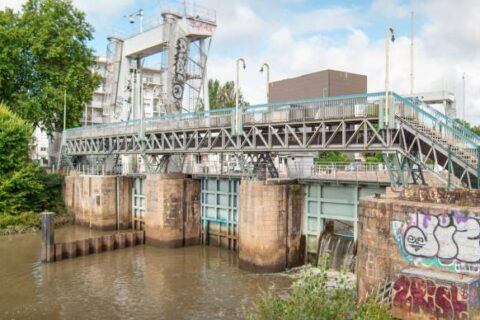
Bridge Expansion Monitoring
As a maintenance planner, I use AML to observe structural expansion joints in combination with temperature and vibration sensors. It helps detect stress accumulation early.
Example : Long-term monitoring of a concrete viaduct in a seismic region.
Riverbank Stability Surveillance
As an environmental engineer, I combine AML with geodetic GNSS and inclinometers to track land movement along riverbanks and embankments.
Example : Monitoring erosion risks and stability of riverbank infrastructure near urban zones.
Retaining Wall Monitoring
As a civil safety officer, I rely on AML to spot early shifts in retaining walls using dense point clouds, validated by soil pressure and crack width sensors.
Example : Monitoring wall displacement at a hillside highway cut.
WE ADAPT
Monitoring Applications
Discover how our LiDARs enable monitor geotechnical, structural, environmental & remote assets.
- Geodetic
- Geotechnical
- Environmental
- Structural
Geodetic Monitoring for Mine Safety
Challenge:
Manual topographic surveys in mines often overlook gradual ground shifts, increasing the risk of unexpected collapses.
Solution:
Inspemon’s AML delivers continuous, high-precision 3D surface monitoring to detect subtle ground deformations in real time.
Benefit:
Early detection of instability supports proactive safety measures, reducing operational risks and protecting workers.

Geotechnical Monitoring for Mine Safety
Challenge:
Traditional inspection methods miss small-scale structural changes in mine walls and slopes, delaying critical interventions.
Solution:
Inspemon’s AML provides automated, high-resolution 3D scans that capture micro-deformations and surface evolution.
Benefit:
Continuous insights enable timely reinforcement and optimized mine operations, ensuring both safety and productivity.


Environmental Monitoring for Dam Conditions
Challenge:
Environmental factors such as rainfall, temperature, and humidity impact dam stability but are often monitored separately from structural data.
Solution:
Inspemon integrates real-time weather (rain, temperature, humidity) and noise monitoring with AML’s deformation data for unified risk analysis.
Benefit:
Detect environmental triggers of dam stress and optimize safety protocols based on holistic data.
Monitoring Movement in a Dam
Challenge:
Cracks and vibrations in dam walls require constant tracking; isolated sensors provide limited spatial context.
Solution:
AML’s 3D scans combined with crackmeters and vibration sensors enable detailed, real-time structural health analysis.
Benefit:
Early detection and localization of structural damage enable proactive interventions to extend dam lifespan and protect communities.
wide range of action
Our solutions
Inspemon got you covered from hardware to software.
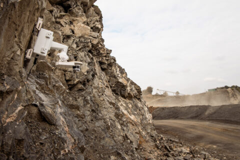
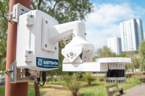
Smart Edge Devices
high-frequency, low-power LiDAR & sensor units
Our edge devices collect detailed point-cloud data and integrate with additional analog/digital sensors, transmitting structured insights securely to your backend systems.
Smart Edge Devices
+ Management Software
Centralize control of all your assets.
Our intuitive platform lets you visualize, analyze, and manage sensor data, configure devices remotely, and integrate seamlessly with your existing IT ecosystem.
